Loading Navigation Data Files
If you have chosen to import navigation data (see Remapping Headers), the Load Navigation Data Files window will be displayed.
The SEG-Y Loader can read columnar text files as well as UKOOA P1/90 files. When importing files containing latitude/longitude, you will be prompted to perform a coordinate conversion to the project CRS.
Note: This step is optional. Instead of importing navigation data, you can enter tie points manually or use a survey from the project. To skip this step, click Next without selecting a file.
Select navigation file
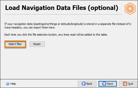
- In the Load Navigation Data Files window, click Select files.
- Browse to the navigation file you wish to import and click Open.
- For a recognised format such as P1/90, Insight will bypass this step and continues with the Load Navigation Data Files window.
- The Import Navigation Data window will be displayed.
Tip: For more information, click on the Help icon at the bottom left.
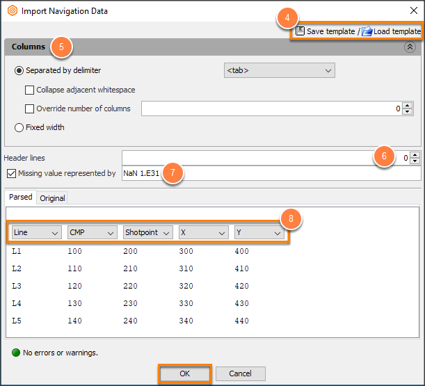
- Save or load an existing import template.
- (Optional) In the Columns section:
- Select the delimiter or use the automatically detected columns.
- Click Collapse adjacent whitespace to remove trailing blanks space in any of the columns.
- Use Override number of columns to specify the number of columns to include.
- Select Fixed width and enter the width of each column.
- If the navigation data includes Header Lines, specify how many lines the headers occupy.
- Click Missing value represented by check box if there are have missing values in your data.
- In the Parsed section, adjust the column(s) representation if they appeared incorrectly.
- Choose what each column represents. Navigation data must include:
- at least CMP and/or Shotpoint columns,
- X/Y or Lat/Long columns.
- The supported coordinate formats for Lat/Long are:
- Decimal degrees : DDD.ddddd e.g. 112.12312E
- Degree-Minute-Seconds : DDDMMSS.ss e.g. 1121234.56E
- If there are no errors or warnings, click OK.
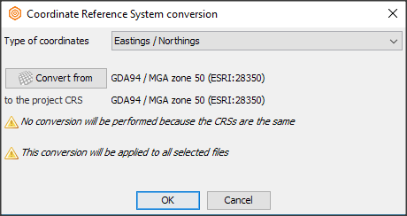
- Select the CRS (if required).
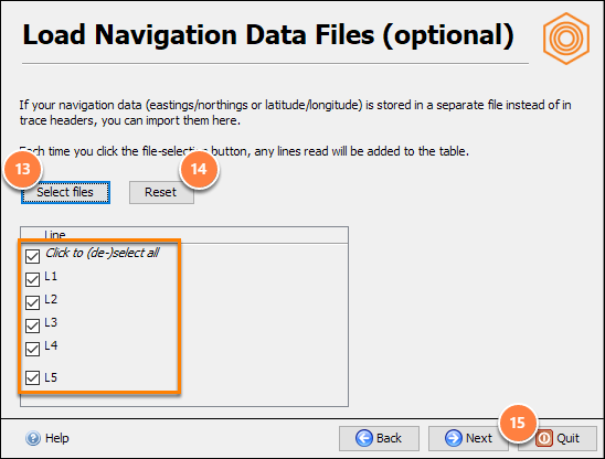
- To exclude line(s) from importing:
- specific line: untick the appropriate line checkbox.
- all lines: tick the Click to (de-)select all checkbox.
- To remove all the lines and select a different navigation data, click Reset and repeat the first step.
- Click Next to proceed to the Survey window.